Wednesday, March 27, 2013

Shaking Out The Gear

The past week has been a relaxing blur of family meals, original Star Trek re-runs, sleeping in, running errands, tuning up and fixing my dad's new-to-him vintage Schwinn, drafting power of attorney documents for my uncle, drafting my final will and testament, becoming an official resident of the Evergreen State, and tying up loose ends.

Quick father-daughter bike ride to test out my work on his vintage Schwinn.
And last but not least, I spent a day shaking out all my bike touring gear in the obnoxiously pink room my mother decorated for my niece.

The gear.  All of it.  So much pink.
Gonzalo and I decided to take advantage of the beautiful sunny 70 degree weather to my first fully loaded test ride.  While I've done shorter bike tours with rear panniers, I've never done fully loaded touring with the addition of the front panniers.  From everything I had read in other trip blogs, I knew there would be a learning curve with respect to how the bike handles with the front panniers.  Most people practice first on flat pavement.  Not thinking particularly clearly, we headed out to Badger Mountain, a local mountain biking and hiking spot.

All geared up at the trailhead (photo credit: Gonzalo).
Well, true to Badger Mountain's name, it was truly a little mountain with a gravel trail that went straight up.  I quickly figured out that I had forgotten to attach the bottom of my handlebar harness, I had put too much weight up front in an overly zealous effort to keep the bike balanced, and the inclusion of all my wishful thinking items had thwarted my efforts to keep my bike tour not-so-fully-loaded.  After rearranging my panniers to move some weight back and to take a few things out that weren't essential or could be easily procured on the road, we started out again.

Nope, not riding up this (photo credit: Gonzalo).
We realized quickly after I nearly crashed out several times that maybe a steep loose gravel trail was not the best place for me to get used to the handling of a fully loaded touring bike.  So we headed to the road and biked alongside the beautiful vineyards of the wineries nearby.  

Much better... too bad we didn't get to taste any wine at this winery (photo credit: Gonzalo)!

I'll definitely need some more practice rides to get used to the handling with the front panniers, but that will come soon enough.  We're off to Seattle tomorrow to visit my brothers!

Saturday, March 23, 2013

4000 Miles Down, 1500 Miles To Go

Idaho welcomed me with my first speeding ticket in over 15 years and another contender for "where LeeAnn could live if and when she comes back to the U.S."  After being given a personal tour of downtown Boise by my friend Melissa, a former co-worker turned fellow law student turned BigLaw monkey turned in house counsel monkey, I was left with the distinct impression that Boise has a wonderful balance of eclectic funky culture, thriving cycling community, mountains, and that elusive warm cozy small-town feel.  That may also have been Melissa's lawyering skills not-so-secretly trying to persuade me to move to Boise as well.

Melissa takes us to a dark back alley with velociraptors.
Jeffkins, this one reminded me of you.
Of particular note was the thriving local craft brew scene and the homebrew supply store around the corner from Melissa's house.

Continuing my local craft beer tour... both the Thunder Monkey and Outlaw were delicious, and paired well with the poutine fries we got.  When in Idaho, eat potatoes.
After a lovely happy hour, we headed back to have homemade tacos made by Melissa's husband and we passed the evening chatting and drinking wine.  The next morning, we were a little worse for the wear, but it was time to head to Richland, WA to my parents' place for some R n' R and to drop off my earthly possessions.

Driving through three snowstorms makes for a dirty Chevy Impala.
Righting my wrong.
What's becoming more and more clear is that when I settle down somewhere again, it will definitely be somewhere Colorado or west.  I find myself surprisingly in love with small towns like Moab or small cities like Boise... so much so that I can't imagine living somewhere like Washington DC again for any extended period of time.

Thursday, March 21, 2013

Thank You Most Chubby President For Mukuntuweap National Monument (d/b/a Zion National Park)

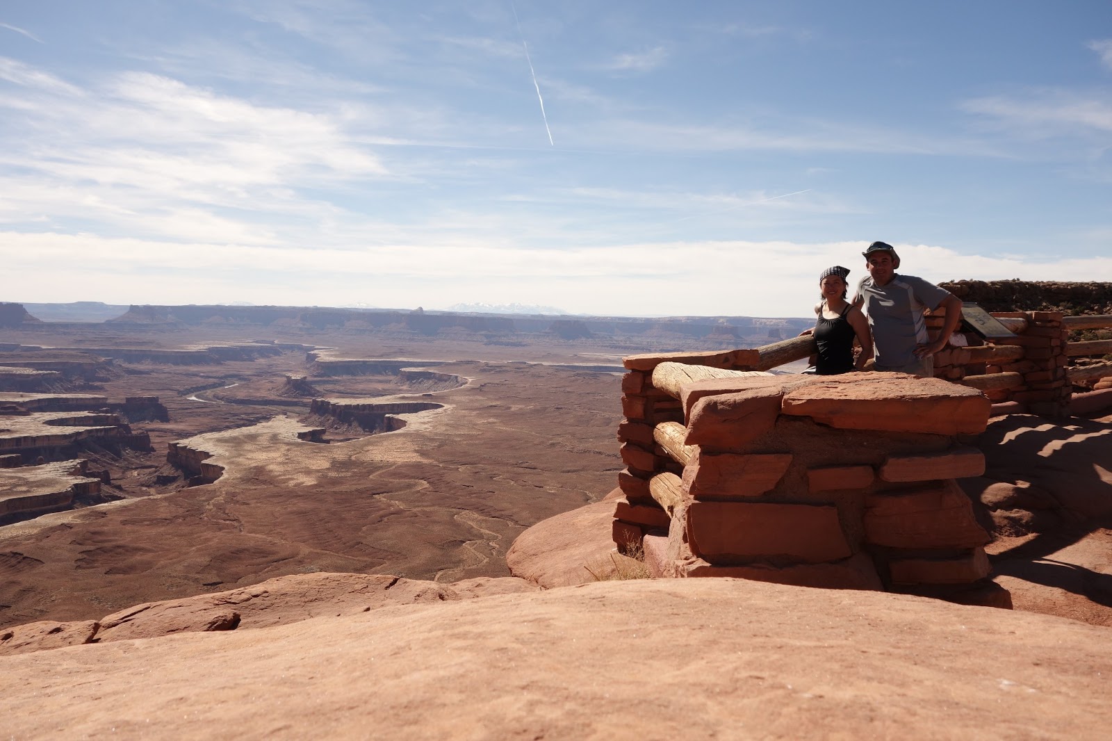
Gonzalo and I found ourselves wishing we had just one more day to shoot the shit with Ron and Mike, one more day to explore Canuyonlands, but it was time to move on to Zion National Park.  We took our time packing up, said our goodbyes, and found ourselves tooling down scenic UT-89 past small towns struggling to stay alive.  We had lunch at the charming Prospector's Cafe in Marysvale, Utah and continued onto the "big" town of Pascuitch to get our grocery shopping done.  The hardest decision of the day was which of the iconic Utah beers to get… the WaSatch Evolution Amber Ale barely edged out the Polygamy Porter.

Pleasantly surprised at the wide selection of local craft brews, including the cycling inspired beers (photo credit: Gonzalo)!
First things first before setting up camp.  I'm a pro at picking the best campsites on the edge at the generally overcrowded national parks.
We had three full days to explore so we picked the three hardest hikes: (1) Angels Landing (with an add-on of Emerald Pools), (2) Hidden Canyon and Observation Point, and (3) as much of the Narrows we could manage without renting the gear.

While not particularly technical, Angels Landing is a big rock fin that you traverse.  The hike requires a steep hike up with a psychological component that makes it difficult for the acrophobic because it requires rock scrambling on a ridge with steep drop offs on both sides.  Although a bit crowded at the summit, we found some solace atop a rock formation and exploring the other side of the summit to the final drop off. 

The true summit of Angels Landing (photo credit: Gonzalo).
Exploring a drop off with cairns set up to mess with us... there was an itty bitty cairn set up just before the cliff edge.
Hidden Canyon and Observation Point started off the same trailhead and offered two very different kind of hikes.  Hidden Canyon is a mostly unmaintained "trail" at the bottom of a canyon with a rock scrambling and climbing obstacle course of sorts.

Gonzalo attempts a technical approach.
The one time being little is an advantage...  (photo credit: Gonzalo).
The hike up to Observation Point, however, is basically straight up and challenging only for the weak-lunged.  Luckily, that's a lot of people and we had the trail to ourselves for most of the hike and I took the time to truly enjoy the silence.

"Photogenic cacti" on the edge of the trail on the Eastern Rim.
Gonzalo teasing a chipmunk with his snack at the top.  It's clear this guy has been fed one too many times.
Aaaaand, sneaky lil bugger.
Taking some time to enjoy the hike down from Observation Point.
This beautiful canyon meandered aside our trail (photo credit: Gonzalo)
Originally, I didn't really intend to hike the Narrows after a friend of mine did it and couldn't walk for weeks afterwards.  I thought maybe we could do some shorter hikes in other parts of the park.  But the Narrows is one of the iconic hikes in Zion that I decided we could make a day of biking from the campsite to the trailhead and see how far we could make it.  We knew that the National Park Service highly recommended wetsuits this time of year, so I dug out my whitewater kayaking/rafting gear, while Gonzalo decided to brave it in what he had.  He also brought his inflatable sleeping pad.

We discovered that at this time of year, the water is not only freezing, but the water levels are high with a fairly swift current.  We spent about an hour battling fast, waist-deep waters and numb feet before we decided to turn back.

Gonzalo takes the first steps into the icy cold waters of the Virgin River.

Later that afternoon after we had warmed up, we did some learning at the Zion Human History Museum, which was small but really interesting.  It was there I discovered that President Taft, our fattest president, proclaimed the area a national monument in 1909.  For those not in the know, I love miscellaneous Taft facts because I did a report on him in middle school, and to this day, he is one of the few early presidents that I can remember anything about.  Anyway, at the time, it was called Mukuntuweap National Monument, but was later changed in 1918 to Zion National Park because it had greater "ethnocentric" appeal.  In other words, it sounded too "native."

On the way back from the museum on the Pa'Rus Trail.
After 10 extraordinary days of camping, hiking, cycling, and not showering, we made it a Motel 6 (from which I write this blog post) just north of Salt Lake City to make ourselves presentable, recharge our electronics, and otherwise just relax with no agenda.  It was a luxurious evening of watching movies and ordering in pizza.  Time to pack up and head out to Boise, Idaho!

Wednesday, March 20, 2013

"While Arches Looks Like Mars, Canyonlands Resembles The Moon"

Gonzalo and I had to tear ourselves away from Arches National Park with the feeling that we needed one or two more days to do everything we wanted to do, despite the fact that we stayed there longer than most people do.  We made the last day count by visiting the iconic Delicate Arch and relishing one last panoramic view.
One last hike out to the Delicate Arch.
One last look at the majestic landscape.
Because the campgrounds at Canyonlands National Park are first come first served, we woke up to a beautiful sunrise and managed to repack the car with surprising efficiency.  In addition to all my earthly possessions and all of Gonzalo's touring gear, we had to bring food and water for the next several days since Canyonlands boasts almost no amenities, save pit toilets and fire rings.  

Once we got to the campgrounds, we had a lazy early afternoon, complete with a big late breakfast, naps in the hammock, and general blissful relaxation.  We finally got motivated after I spent a little time figuring out some easy things for us to do, including a short bike ride to some scenic viewpoints.

View down the road from our campsite (photo credit: Gonzalo).
Mesa Arch.
I'm not sure why Canyonlands gets the proverbial shaft in comparison to Arches as it has a vast beauty that is nearly impossible to capture in a picture.  We sat at each spot simply soaking in the view and attempting to imprint the awe we felt at the view.  We are already in love with Canyonlands, it's eerily quiet here in comparison to Arches and the few folks that make it this way simply drive through if they have an afternoon to spare coming out of Moab. We feel like we've stumbled on the greatest secret ever.

Absolutely unreal.
We decided that we would make the drive to the Grand View Point Overlook shortly before sunset, schlep a stove and some hot chocolate, and watch the sun set over a 360 degree panorama.

Creating the moment at sunset... Thanks to Tyson for leaving the leftover Amarula!
Trying desperately to burn the view into my memory (photo credit: Gonzalo).
The real reason for my detour to Canyonlands was not just its close proximity to Arches or its views, but rather because mountain bikers come for the bragging rights that come with bombing down the Shafer Trail and riding White Rim Road.  It wasn't until we stared down the 1400 foot descent over the course of 5 miles that we understood what a gem we had discovered.  And luck would have it, Shafer Trail was closed to 4WD traffic so we had a blissfully empty trail to run.  We took our time and gave our bikes their well-deserved glamour shots tour as well.

Shafer Trail Road from the top... we rode this bad boy five miles down to rock White Rim Road.  We also made the arduous climb out.
With no 4WD traffic, we had an open playground.
That speck is Gonzalo rocking the descent on his touring bike.
My baby in sleek mountain biking mode.

One of many slightly dangerous (for our bikes) glamour shots.
My Troll proves she's fit for dirt (photo credit: Gonzalo).
Taking in the view (photo credit: Gonzalo).
The long climb out (photo credit: Gonzalo, who is a beast on wheels up the hills and had me by a couple switchbacks).
The campgrounds at the Island in the Sky section of Canyonlands boasts just 12 campsites, which just adds to the entire experience.  Our neighbors were a wonderful duo of aging bachelors, Ron and Mike, who welcomed us into their fold, let us borrow their axe, made us tasty elk burgers, and kept us entertained with banter around the fire pit for hours.  If you are ever in the vicinity of Mount Rushmore, go find Red's Chicken House and BBQ and ask for Ron and feel like a king for a day.  

Shenanigans around the campfire (photo credit: Gonzalo).

*** The title to this post is quoted from Fodor's guide to the National Parks of the West.

Wednesday, March 13, 2013

Dear Utah, I Love You (aka Arches National Park)

Arches National Park is one of those places that can be easily overlooked as a "driving tour" type of park.  The views from the main road which winds through the park are stunning enough to satisfy most outdoors enthusiasts.  Gonzalo and I were greeted by the friendly camp host, an aging redneck of sorts with passion for his job and a personal vendetta against "foreigners" (... mostly Europeans, he clarified, when he found out Gonzalo was from Mexico) trying to circumvent the U.S. National Park system to avoid paying.  He was very excited that we had booked three nights since most folks are in and out in a day or two.  It wasn't until we started hiking that we understood why it's worth taking a few extra days to enjoy this park.

The roads have not been kind to my rental car, but the view from the campsite is spectacular (photo credit: Gonzalo).
Exploring the base of one of a bazillion arches.  This is clearly hard work.
Sometimes its worth looking back to see where you've been. 
Sunset from the campsite.
Somewhere along the way, something happened to my rear hub.  My first reaction was to take the bike into Moab to the first bike shop I saw.  Bollocks.  I would not have a bike shop for much of my trip, so I pulled out my bible of bike repair, the Park Tool School blue book of bike repair, set up shop at the picnic table, and successfully did my first hub adjustment.  Thanks to Bill at Capitol Hill Bikes for having the foresight to include the appropriate wrenches for this task!

Best bike repair shop ever.
Success!  We rode our bikes to the trailhead later that day.
The rest of the day was spent exploring the Devils Garden trail, where we traversed ledges, climbed everything in sight, and otherwise made the most of the perfect weather we were blessed with for this portion of our trip.  Maybe this was Mother Nature's apology for the two winter storms I had to drive through.

I never get sick of this view (photo credit: Gonzalo).
Fun with shadows!
We made sure to take our time and not rush (photo credit: Gonzalo).
One of many exploratory climbs (photo credit: Gonzalo).
One of the last hikes later in the day... (photo credit: Gonzalo).
The one downside to the day was the possible sacrifice of my 17mm wide angle lens when I was descending onto a ledge.  The lens no longer allows me to take pictures, but luckily, I had different lens packed away in one of the boxes in my trunk.

RIP.
Even though we are staying in Arches National Park one more night, we needed to go to Moab to get provisions for Canyonlands and figured we could hit up some of the hikes that are closer to the entrance of the park since we've explored mostly the area near our campgrounds.  We decided to try out Love Muffin Cafe (from which I write this post), which Lauren told us was the best breakfast in town.  And holy crap was she right.  We had intended to stop just for coffee, and stayed for poutine and banh mi.  Now I'm off for groceries and more hiking.